


Gatineau River: Then and Now
Lower Gatineau River from the air in 1926 and 1997
Set 4 - Tenaga to the Eaton Chute, Kirk's Ferry (Click on images for additional details)
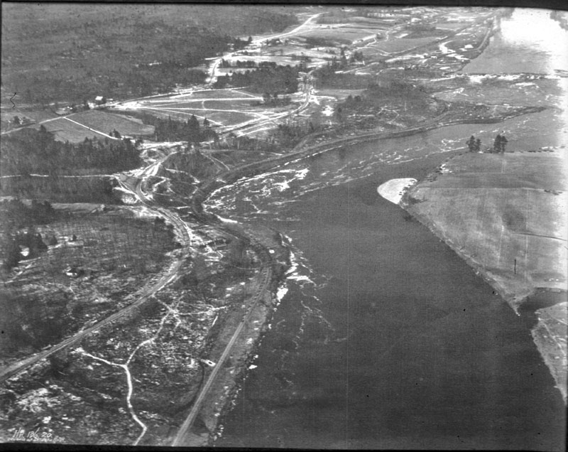
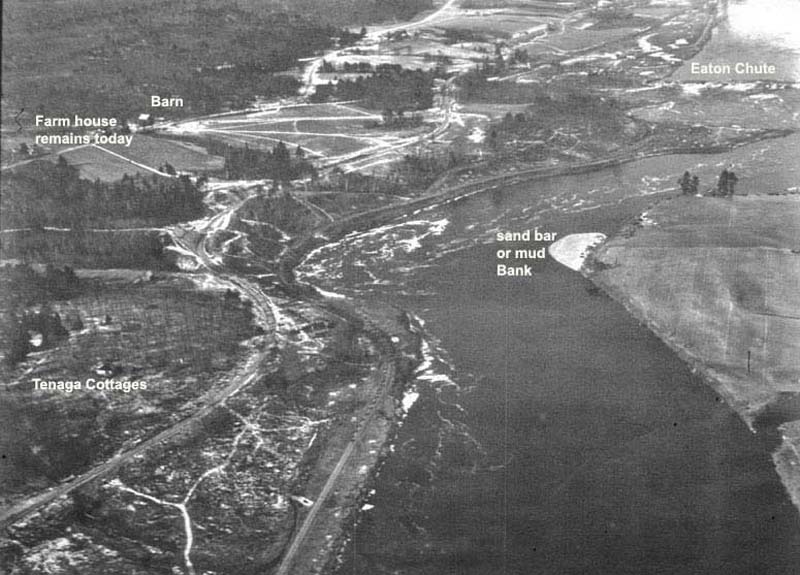
In the THEN image, Eaton Chute, a substantial waterfall, is just visible near the top right corner of the image. In the lower left corner of the THEN image, several Tenaga cottages are visible. To the right, across the river is a white sandbar or mud bank.
In the NOW image, Eaton Chute is flooded, and a new island appears midway up the photo.
Then image (click)
Eaton Chute
See also
annotated image
Now image (click)
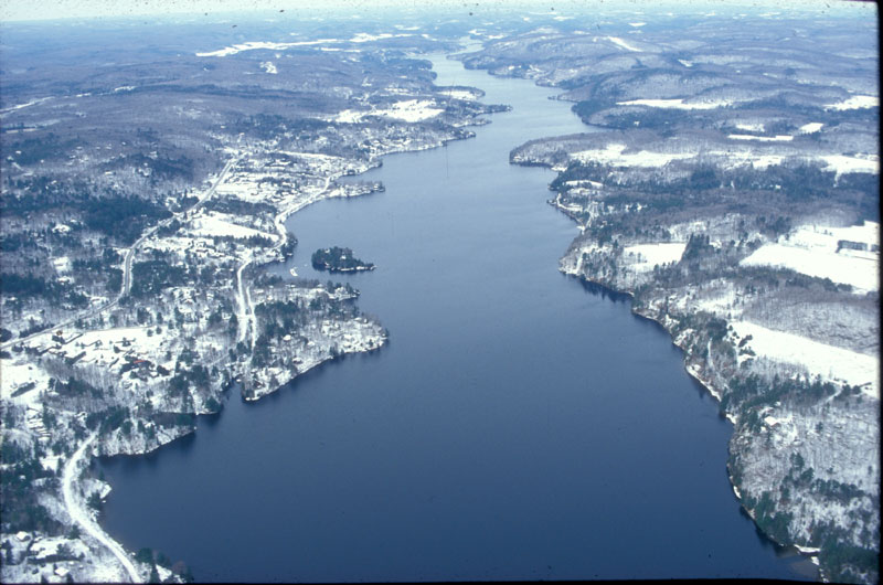
Disappearance of the Eaton Chute